
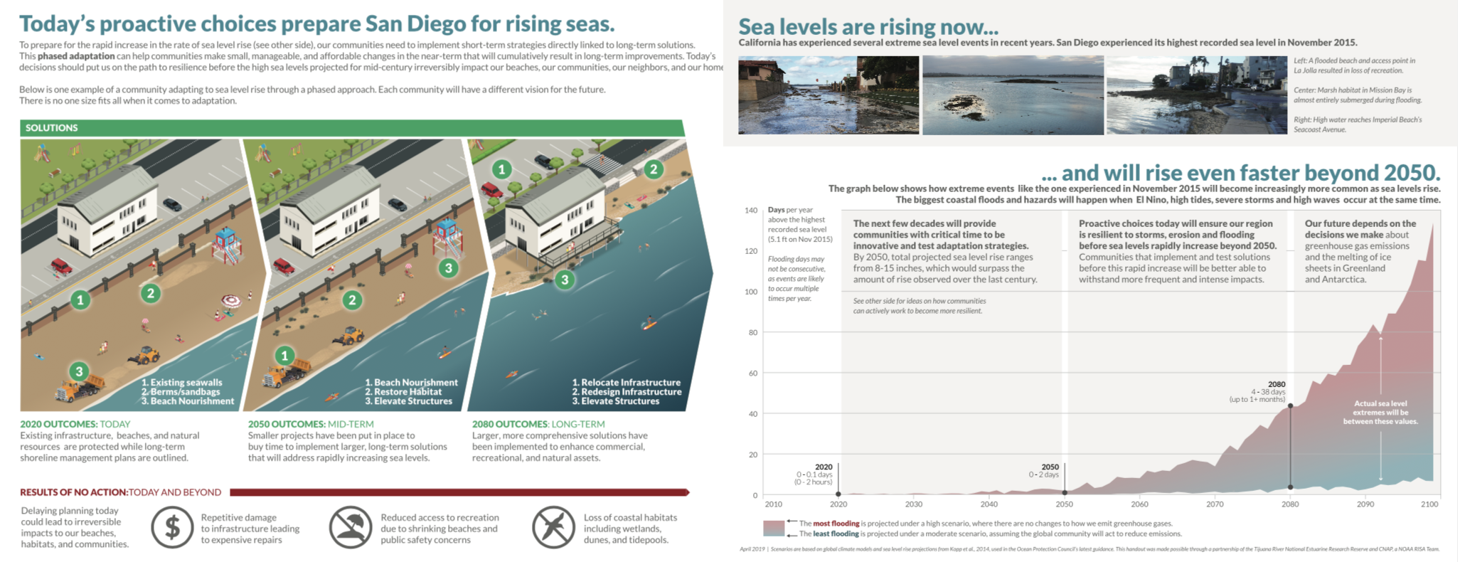
CNAP and the Tijuana River National Estuarine Research Reserve developed a handout and associated powerpoint graphics to help communicate the current state of the science, and how to plan for future sea level rise and extreme events. The hand out illustrates a phased management approach that encourages proactive planning for sea level rise to mitigate damage from extreme events and prepare for sea level rise in the future. The handout uses San Diego specific data and includes pictures that illustrate the impacts of a recent extreme sea level events in San Diego. The handout pictured below focuses on San Diego Region and uses regional data and local pictures. This was developed based on feedback from San Diego Regional city planners, CA Coastal Commission, and sea level rise experts throughout California.
Additional handouts using regional specific data and pictures for the Los Angeles Region and Central Coast Region have also been developed. Handouts for the San Francisco Bay Region and North coast are in development.
Click Below for the Regional Specific Handouts
San Diego Region
Los Angeles Region
Central Coast Region
This was developed with the intention that local planners and regional sea level rise adaptation experts can use this handout and/or powerpoint slides to communicate to the public and elected officials. Please contact Julie (jkalansky@ucsd.edu) for more information about the product or for a powerpoint presentation.